Four analyses holding the City to account
Each piece takes one line of argument in full, backed by the City's own documents.
The Cost of Development Without Infrastructure
If the City permanently disposes of this public land without first securing commitments and budgets for key civil services, local infrastructure could come under severe strain. The figures below are independent projections compiled by residents, not the City's own figures, using standard planning and engineering methodologies. They are estimates offered for public debate; each card sets out the model and assumptions behind it. See Sources & Methodology.
On our model, commuting into Pinelands along Forest Drive could swell from a ten-minute trip to an estimated fifty-minute gridlock, a projected 109% increase over current traffic volumes (33,000 vpd) on Forest Drive.
Projected volume of raw, untreated sewage that could bypass into the Vygekraal and Black River system each day if treatment capacity is not upgraded first. The Athlone WWTW has a design capacity of about 105 ML/day and was roughly 76% utilised in the 2021 Green Drop audit, leaving little headroom for new load.
Additional metropolitan water deficit, threatening local water pressure drops and rationing. This new demand represents a 0.46% increase over the City's daily water consumption target (975 ML/day).
Local school children could be displaced from nearby education, potentially forcing hours of extra cross-suburb travel, a projected ~97% increase in demand for local school places (2011 Census: 1,517 children aged 5 to 14 in Pinelands).
A massive new urban area added to existing neighborhoods, equivalent to roughly 125% of Pinelands' current population.
Estimated potential loss in property value for homes across directly and indirectly affected neighborhoods.
The draft development concept (May 2026)
The City proposes replacing the golf course and surrounding public land with a highly dense commercial and residential precinct. Below are the figures sourced directly from the official draft project documents.
The current strategy outlines a heavy infrastructure injection to sustain this capacity, placing a massive demand footprint on transport, waste, and municipal services.
| Component description | Proposed scale |
|---|---|
| Open-market residential units | ~4,600 units |
| Affordable residential units (none on Parcel B) | ~1,900 units |
| Total residential units | ~6,000–6,700 units |
| Office space | 42,870 m² |
| Retail precinct | 23,390 m² |
| Light industrial zone | 8,527 m² |
| New road network, commercial precinct, school | Confirmed |
| General building heights | 4–8 storeys |
| Terrace structures along Links Drive | 2–3 storeys |
Source: City of Cape Town / Infinity Environmental, Draft Development Concept Information Document, King David Mowbray Golf Course and surrounds, May 2026.
Eight Crucial Planning Contradictions
A review of statutory documents and audit records reveals deep structural deficits in the City's current evidence base. The permanent disposal is being rushed before the key technical studies are complete.
1
The transport strategy rests on a rail station that does not exist.
The entire transport backbone for a proposed ~6,700 homes and ~75,000 m² of commercial space is a proposed new railway station between Pinelands and Langa. This station appears nowhere in Prasa's Corporate Plans for 2024/2027, 2025/26, or 2026/27–2028/29. The most recent plan, whose final version is dated 30 March 2026 (two months before the City's Information Document), names the Central Line priority in the Western Cape as resolving encroachment of the rail reserve (p.31), not new stations. There is no capital allocation, no timeline, no scoping. And in response to formal access-to-information requests, the City has now sworn, under affidavit, that it holds no feasibility study, business case or agreement for the station, and Prasa has confirmed in writing that no commitment of any kind was concluded.
Forest Drive, the principal road serving this area, cannot be widened. The City confirmed this on the record at the 26 February 2025 public meeting.
A trip is one one-way vehicle movement, and each home makes several every day: the school run, work, shopping and the rest. On top of the homes, the ~75,000 m² of office, retail and light industry generates a large share of trips of its own, independent of the residents. Using the standard South African method, the TMH 17 Trip Data Manual, we estimate the development would add between 25,000 and 36,000 vehicle trips a day. These are our own estimates, not the City's, and the City's full Traffic Impact Assessment has not been released.
How bad the traffic gets depends entirely on the train. Best case, the station is built and a highly optimistic 30% of residents switch to rail: even then the development adds roughly 25,000 vehicle trips a day to a Forest Drive the City confirms cannot be widened. Worst case, the station is never built or residents keep driving, and close to the full load, in the order of 36,000 trips a day, lands on the road network.
The worst case is the likely one. The proposed station sits on the Central Line, which was suspended in October 2019 and saw only partial service resume in March 2023, and which has been repeatedly vandalised and encroached on, with 36 trains damaged by stone-throwing as recently as October 2024. Western Cape rail ridership stood at roughly 22.7 million passenger journeys in the 2024/25 financial year (Prasa's own 2024/25 Annual Report), a fraction of its former level. Rail is also the least-used mode in the country: in the Western Cape only about 1.6% of household members travel by train (Statistics South Africa, National Household Travel Survey 2020). Car dependence rises with income, and this development is majority open-market housing, the group least likely to use a train, which makes a 30% rail mode-shift generous even if the station is somehow built.
The Information Document (p.27) proposes Forest Drive improvements (signal optimisation and lane reconfiguration at Forest Drive/St Stephens, signalisation of Forest Drive/The Crescent, and two mini-roundabouts), but these are unfunded and, on our assessment, far short of what tens of thousands of extra daily trips would require on a road that the City itself confirms cannot be widened.
The concept also proposes new vehicular connections onto Jan Smuts Drive and the N2. The N2 is a national road under SANRAL's jurisdiction. There is no public SANRAL project or approval for new development access at this location. SANRAL is currently widening the N2 in Cape Town (Swartklip to Baden Powell, four to six or eight lanes, ~R2 billion), a project that protects the corridor for future capacity. The ITS Engineers Traffic Impact Assessment, which would show whether any grade-separated access structure is required at the N2, has not been released.
2
The sewage treatment plant receiving this development is currently non-compliant.
The Athlone Wastewater Treatment Works (WWTW), which would receive the development's sewage, scored only 15% microbiological compliance and 54% chemical compliance in the 2022 Department of Water and Sanitation Green Drop audit, against the 90% certification threshold for both. It is currently discharging non-compliant effluent into the Vygekraal and Black River system.
The City's multi-year upgrade of the plant is not scheduled for completion until 2029. The development would add an estimated 3.4 to 4.5 ML/day of additional load.
The City's own Information Document acknowledges existing sewer pipes lack capacity and that phasing will need to align with treatment upgrades, but no capacity letter has been obtained.
3
Cape Town's water system is already over its sustainable yield.
The City's own Water Outlook (June 2025) records that Cape Town is consuming 1,014 ML/day against a target of 975 ML/day, which is 4% over the restoration target. The New Water Programme supplying an additional 300 ML/day has slipped to December 2031.
The development would add an estimated 3.4 to 5.0 ML/day of additional water demand before any new supply augmentations are online.
4
The land was valued before the studies that determine its value were done.
The City has produced two desktop valuations: approximately R171 million (31 March 2024) and approximately R395 million (31 March 2026). On enquiry, the City stated that the increase reflects the inclusion of an additional portion of land, so the two figures are not a like-for-like comparison. The R395 million figure appeared in no public document and was disclosed only after direct public questioning.
Neither figure can be reliable regardless of the direction of movement. The value of development land is almost entirely a function of what it will be permitted to become. On both valuation dates, not one of the required determinations had been finalised: no Environmental Impact Assessment, no heritage assessment, no water authorisation, no rezoning. MATR Regulation 11 requires the Council to be informed of fair market value before approving disposal. A pre-EIA desktop valuation cannot satisfy that standard (Maccsand v City of Cape Town [2012] ZACC 7). Neither valuation report, the methodology, comparables, nor the per-portion breakdown has been released.
Read the full analysis of the valuation problem.
5
All the statutory approvals come after the disposal.
Their own document (page 32) lists the following as future work, which will be executed after this engagement closes:
- Environmental Impact Assessment (NEMA, multiple Listing Notice activities triggered)
- Heritage Impact Assessment (Heritage Western Cape has been consulted; HIA likely required)
- National Water Act authorisation (watercourse alteration)
- Town planning: subdivision, consolidation, and rezoning
You are being asked to support the permanent disposal of 42.8 hectares of public land before a single one of these approvals exists. The evidence base for this decision does not yet exist.
6
The Council resolution authorising this process was amended after objections began.
The original Council resolution authorising this public participation process, C28/10/24, adopted in October 2024, was challenged during the 2025 engagement round for a specific legal problem: it only covered Portions A and C of the development site. Portion B (the golf course itself, the green space at the centre of this entire process) was not included. That challenge was raised in writing. The City provided no substantive response.
On 27 May 2026, while the current round of engagement was already underway, the City adopted a new resolution, C39/05/26, amending C28/10/24 to include all three portions. The City's position is that the process is "procedurally sound." What has not been explained is how a retroactive amendment, adopted while the defective process is already running, in apparent response to a challenge raised the previous year, cures an authorisation defect that predates it.
The Council minutes underlying C39/05/26 have not been made public. We'll update this page when they are.
7
The City's own climate plan, flood policy and Elsieskraal restoration programme all argue against this disposal.
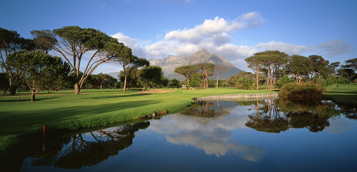
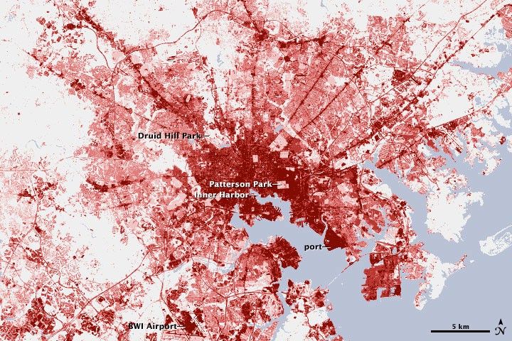
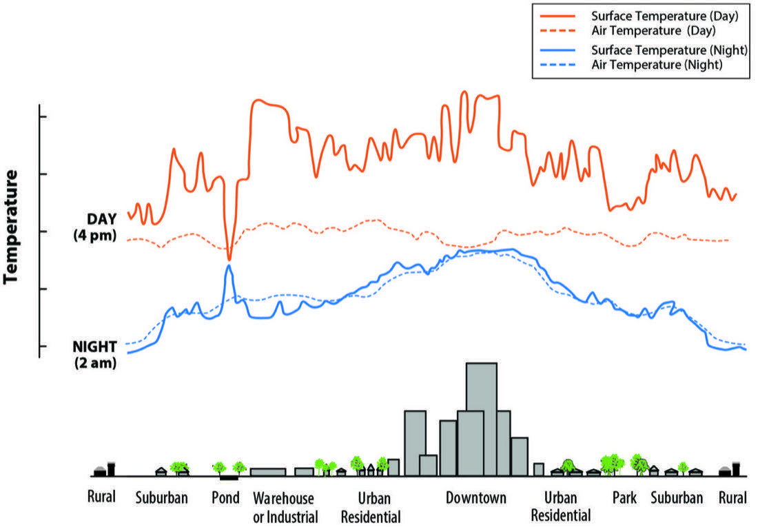
The City's Climate Change Action Plan warns that heatwaves will increase in frequency and intensity, and its heat-mapping identifies the least-green neighbourhoods as the hottest. It is proposing to remove one of the largest cooling assets in this part of the city.
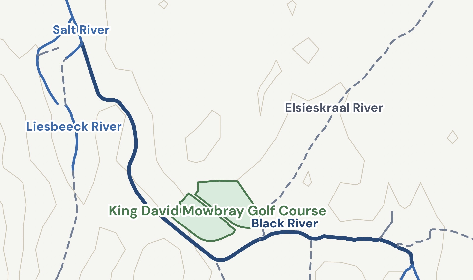
The baseline river and wetland assessment for this site records: "These wetlands are severely modified but important in providing flood alleviation and stormwater management functions in an otherwise hardened catchment." The City accepts this function in writing. On the established hydrology, adding hard surface to a catchment increases and speeds up runoff, so hardening this one works against the very function the assessment records.
Right now, the City is working with the C40 Cities Finance Facility on a programme to rehabilitate wetlands and increase green space in the Elsieskraal catchment. In the same catchment, this proposal would permanently dispose of 42.8 hectares of that same floodplain and green space. One programme restores. The other develops.
Read the full analysis of the City's climate self-contradiction.
8
The tribunal that would approve the rezoning is itself under question.
The City says the later rezoning will provide proper scrutiny. But the independence of the body that decides it, the City's Municipal Planning Tribunal, has been publicly questioned. As Daily Maverick reported on 7 June 2026, in June 2025, days before the tribunal's long-serving chair reached the ten-year service limit set by national planning law (SPLUMA), the City amended its by-law to remove that limit and to allow members to be reappointed after a one-month gap, and the chair was subsequently reappointed. The by-law amendment itself is a matter of public record (Western Cape Provincial Gazette Extraordinary No. 9117, 8 August 2025).
In the earlier River Club case, as reported by GroundUp, the same tribunal approved a rezoning over roughly 180 objections, and stated it had not considered the Heritage Western Cape appeal or the City's own environmental department's objection before it. Being told to rely on the rezoning step assumes that step is independent. That assumption is now in doubt.
9
A project of this scale has no local precedent, and no delivery risk analysis has been published.
A development of roughly 6,700 units with river works, major bulk infrastructure, and a proposed new transport interchange is a project of unusual scale for Cape Town. There is no directly comparable local precedent to plan against.
Research by Professor Bent Flyvbjerg (University of Oxford) across thousands of large infrastructure and development projects finds that 70 to 90 per cent of complex projects run over budget and under-deliver on scope, and that the risk is greatest where there is no comparable precedent. The concern is not that this development will fail, but that the City's Information Document contains no risk analysis of what happens to the surrounding infrastructure, the affordable housing commitments, and the public land if delivery stalls, phases are dropped, or the development is restructured mid-process. A disposal is permanent. The conditions attached to it may not be.
Register your objection before 7 August 2026
Every person who emails their objection is registered as an Interested and Affected Party (I&AP) with formal standing in every subsequent legal phase of this process.
Leave your details so we can keep you updated as the campaign develops, then we'll take you straight to the objection steps.
1. Formal Objection (Primary)
This is the most critical step. Sending a formal objection establishes your legal standing in the upcoming EIA, Heritage Impact Assessment, and rezoning processes. It takes two minutes.
Submit objection emailOr copy addresses manually:
mowbray@infinity.capetown
Development.Mowbray@capetown.gov.za
2. Sign the DearSA petition
Add your name to the public petition on DearSA. Signatures don't carry the same legal weight as individual I&AP registrations, but they demonstrate the scale of community concern to decision-makers.
Sign the petitionAnd share this page with neighbours so they can register their objection before 7 August.
Copy-paste objection template
If your mail client does not support automatic pre-filling, or if you prefer to write a custom letter, copy the text below and customize the bracketed fields.
Review template draft
Subject: Objection and I&AP Registration: King David Mowbray Golf Course Redevelopment

I wish to register as an Interested and Affected Party in the proposed redevelopment of the King David Mowbray Golf Course precinct, and to submit the following preliminary objections.

I am a resident of [suburb], Cape Town, and a member of the community directly affected by this proposal.

Having reviewed the May 2026 Draft Development Concept Information Document, I object to the current process on the following grounds.

The City's own document (page 32) confirms that the Environmental Impact Assessment, Heritage Impact Assessment, National Water Act authorisation, and town planning rezoning are all listed as future processes. Asking the public to comment on permanent asset disposal before this evidence base exists is procedurally inadequate.

The civil services assessment (page 31) states that infrastructure upgrade requirements "will be determined following the capacity letter from the City of Cape Town." This letter has not been obtained. The Athlone Wastewater Treatment Works, which would receive this development's sewage, recorded only 15% microbiological compliance in the 2022 DWS Green Drop audit and is currently discharging non-compliant effluent into the Black River. The upgrade that would add sufficient treatment capacity has not yet been delivered.

The transport strategy depends entirely on a new railway station between Pinelands and Langa for which there is no Prasa commitment, capital allocation, or timeline in any public Prasa document, and which the City has since sworn, under affidavit, does not exist as any study, agreement or budget line.

I request that the disposal process be paused until all specialist studies are complete and available for public comment, and that the comment period be extended accordingly.

[Full name]
[Address, Cape Town]
[Email / phone]
Coverage of this campaign
Independent reporting on the proposed disposal and the community response. These are third-party news reports, linked for context; their words are the outlets' own.
-
Cape Town extends public comment period on Mowbray Golf Club redevelopment
Moneyweb · July 2026
-
King David Mowbray Golf Club redevelopment: public comment period extended until August 7
Southern Suburbs Tatler · 8 July 2026
-
Residents fear massive Pinelands development could overwhelm infrastructure and erase community assets
Sunday Times · 10 June 2026
-
Battle brewing over plan to turn Cape Town golf course into housing precinct
News24 · 1 June 2026
-
Is the King David Golf Club development proposal a threat to community spaces?
Southern Suburbs Tatler · 9 June 2026
-
King David Mowbray development faces community backlash
Cape Town Etc · June 2026
-
Pinelands development plan threatens Cape Town's oldest golf club
People's Post · June 2026
-
Battle brewing over plan to redevelop King David Mowbray Golf Course
The South African · June 2026
What Cllr Jack Miller said in Council
Councillor Jack Miller (Cape Independence Party) addressed the Cape Town City Council on the King David Mowbray Golf Course disposal process. His remarks are reproduced here in full.
Can you believe it? Now the DA wants to destroy the historic Mowbray Golf Course. The Mowbray Golf Course is older than the formation of South Africa. It was founded over 115 years ago, just before the Union of South Africa was created by the British Empire after the Boer Wars in 1910. Capetonians were playing golf here in a self-governing and independent Cape. Today, it has some of the most beautiful views of Table Mountain, and its membership is a true Cape Rainbow Nation, with its renowned sporting facilities being home to all of the diverse Cape communities that surround it. It is a flagship in sporting inclusivity. It has such impressive facilities that it has hosted the SA Open on seven different occasions, with the world-famous Gary Player winning the event twice. But even all of this can't keep the DA's low-cost housing wolves away.
So here we are, over 115 years later, and this plot of land that has brought Cape communities together for over a century is on the verge of being destroyed — like so many other places in Cape Town already have been by the DA and its endless population densification agenda.
Cape Town has consistently ranked in the top 10 most beautiful cities in the world. Why is that? Because as a city, we are naturally nestled within Mother Nature, surrounded by impenetrable oceans and large mountains. Tourists flock here from far and wide for this very reason, and our city's economy is largely driven by this fact.
Many other cities around the world are plots of land on flat kilometres with an industrial economy, like Johannesburg. The only limitation on building is as far as the city's residents wish to expand. However, here in Cape Town, we don't have that freedom or space, and we are not a manufacturing and industrial flatland. If people want that, they are welcome to live in Johannesburg, Harare or Lagos. And if the DA gets its way, Cape Town will soon look like Johannesburg, Harare, or Lagos. In fact, if things carry on at this rate, there will not be a single open field, community park, nature reserve, sporting ground, or natural fynbos left in the city.
Ironically, I would like to remind the DA here that the very carbon dioxide their environmental policies hate so much is the same carbon dioxide that plants breathe, and in return, those same beautiful plants give us back oxygen. It's a good deal, and it's been working well. I would therefore like to urge the DA to reconsider its attempts to impose low-cost housing projects on every last piece of nature or open land that they can find.
Cape Town does not have the large-scale manufacturing and industry to handle the population size and density that the DA is now forcibly imposing on us. The city's over 20% unemployment is a clear signal that the city's economy is buckling under the pressure of too many people. Cities need to grow organically, at rates that are naturally in line with the size of their economies, available space, and inherent structure. It seems as if Cape Town has become some strange experiment to see how much weight and strain a community, an economy, and an ecology can handle. Otherwise, none of this makes any sense whatsoever — it is insane.
Once every golf course, natural fynbos, open park, and nature reserve has either been taken over by illegal land invaders, or done so on their behalf by the City of Cape Town's low-cost housing department, everything that has made Cape Town what it is will be gone forever. And we will have become an over-polluted, overpopulated, impoverished wasteland of high-density high-rise buildings, informal settlements, and slums. But there is still time for us to pull it all back before it's too late. Cape Exit opposes this DA proposal to turn the historic Mowbray Golf Course into a high-density, low-cost housing project. We hope you will, too. Thank you.
Last updated: 14 July 2026
How to read the figures on this page
This site distinguishes three kinds of statement, and asks readers to treat them accordingly:
- Facts are drawn directly from the public documents listed below and are cited in context (with page numbers where applicable).
- Projections, the figures in the impact cards (traffic delay, sewage load, water demand, school places, population, property value), are our own estimates, produced with the standard methodologies set out below. They are not the City's figures, and reasonable analysts may reach different numbers under different assumptions.
- Opinions and inferences are the conclusions we draw from those facts and projections. They are offered as fair comment on a matter of public interest and are identified with phrases such as "in our view" or "in our assessment".
Primary source documents
- City of Cape Town / Infinity Environmental, Draft Development Concept Information Document, King David Mowbray Golf Course and surrounds, May 2026 (esp. p.31 civil services, p.32 future statutory processes), primary source for proposed development programme figures.
- City of Cape Town, Water Outlook, Edition Twelve, June 2025.
- Department of Water and Sanitation, Green Drop Report 2022 (Western Cape), Athlone WWTW.
- City of Cape Town, media releases on the Athlone WWTW upgrade programme.
- PRASA, Corporate Plan 2024–2027 and Corporate Plan 2025/26.
- City of Cape Town, public meeting notes, 26 February 2025.
- City of Cape Town, Information Pack (R171m desktop valuation, 31 March 2024); Property Development Department letter of 12 June 2026 (R395m desktop valuation, 31 March 2026; additional-land explanation).
- Statistics South Africa, Census 2011 (Pinelands small-area data).
- Municipal Asset Transfer Regulations (GN R878 of 2008), Reg. 7 & Reg. 11; NEMA EIA Regulations 2014 (as amended); National Heritage Resources Act s38; National Water Act s21; Maccsand (Pty) Ltd v City of Cape Town [2012] ZACC 7.
- Bent Flyvbjerg, "The Iron Law of Megaproject Management", University of Oxford.
- Committee of Transport Officials (COTO), TMH 17 South African Trip Data Manual, 2012; Highway Capacity Manual (Level of Service framework).
Projection methodology, in brief
- Traffic: trip generation from TMH 17 rates applied to the proposed unit and floor-area mix, assessed against Forest Drive's current volume using the Highway Capacity Manual Level-of-Service framework. Assumes an optimistic 30% rail mode-shift even though no station is committed.
- Sewage & water: hydraulic demand of ~400 L/household/day plus commercial load, compared against the Athlone WWTW inflow figures and the City's stated metropolitan water balance.
- Schools & population: standard student-yield (0.22 learners/household) and occupancy ratios (2.5–2.8 people/unit) applied to the proposed ~6,700 units (City of Cape Town draft concept, May 2026), against 2011 Census baselines.
- Property value: an illustrative comparative estimate (5,000 properties × 15% average devaluation); the most assumption-dependent figure on the page and presented as indicative only.
Where any figure or quotation is shown to be inaccurate, it will be corrected promptly. This site is independent civic commentary and opinion on a matter of public interest; it makes no allegation of unlawful conduct by any named individual, and carries no political or commercial affiliation. If you are referred to here and wish to respond, we welcome a right of reply at info@pinelandsmowbray.org.za. See our Privacy notice.